DJI
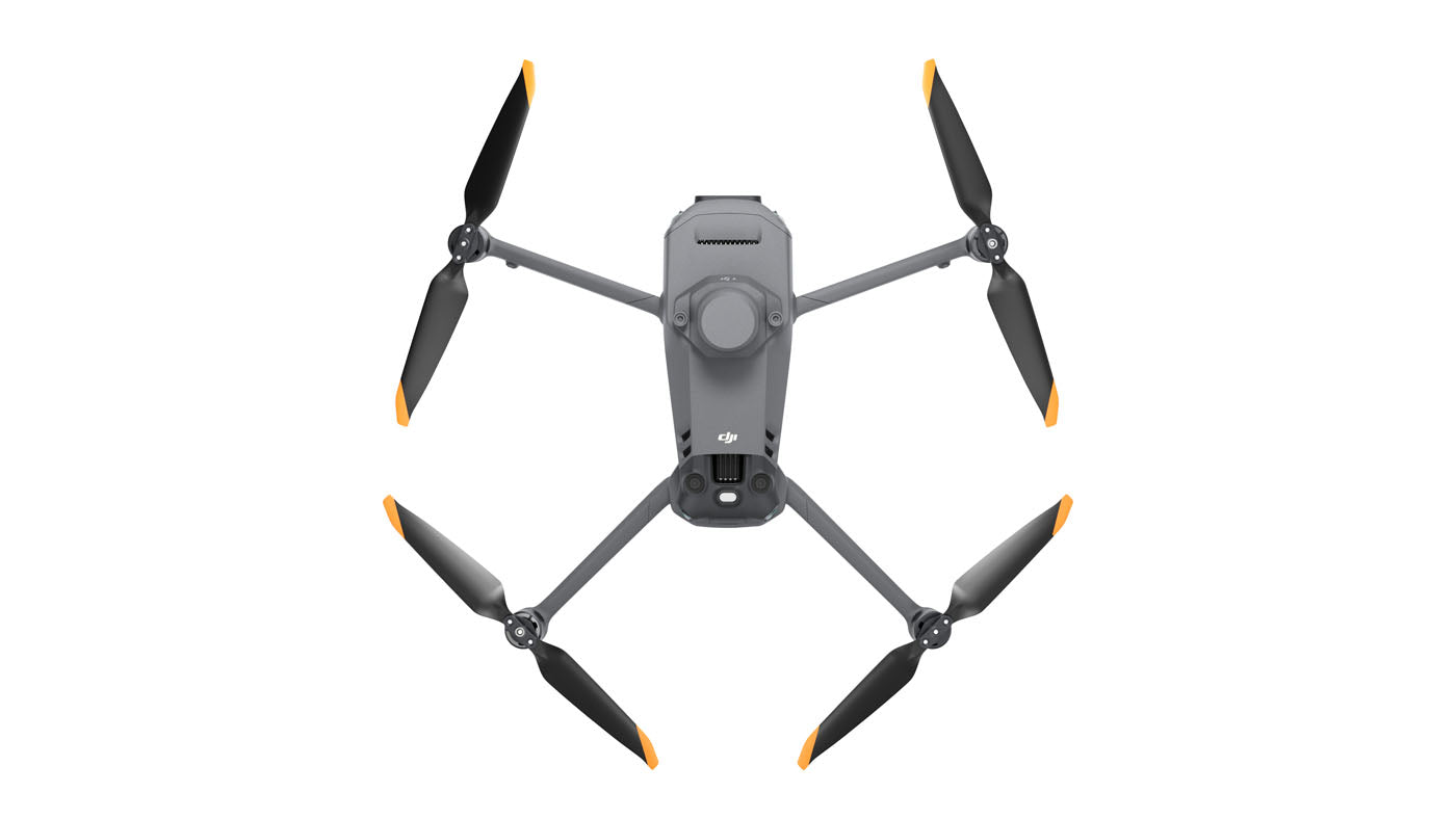
DJI Mavic 3M Multispectral
DJI Mavic 3M Multispectral
Couldn't load pickup availability
Product Overview
The DJI Mavic 3M Multispectral is a compact mapping and agricultural-imaging drone designed for crop monitoring, vegetation analysis, orchard mapping, environmental surveys, natural-resource assessment, and other professional data-collection workflows.
Its integrated imaging system combines a 20MP 4/3 CMOS RGB camera with four 5MP multispectral cameras that capture green, red, red-edge, and near-infrared bands. An integrated sunlight sensor records solar-irradiance information to support consistent multispectral data processing over time.
The aircraft also includes an integrated RTK module, omnidirectional vision sensing, DJI O3 Enterprise transmission, a mechanical shutter, and a published maximum flight time of up to 43 minutes under DJI test conditions.
Authorized reseller through Drone Nerds.
Key Features
- Integrated RGB and multispectral imaging system
- 20MP 4/3 CMOS RGB camera
- Mechanical shutter with speeds up to 1/2000 second
- Four 5MP multispectral cameras
- Green, red, red-edge, and near-infrared spectral bands
- Built-in sunlight sensor for solar-irradiance data collection
- Integrated RTK module for high-precision positioning workflows
- Microsecond-level synchronization between the cameras, flight controller, and RTK module
- Omnidirectional binocular vision sensing with a downward infrared sensor
- Terrain-follow mapping support for compatible missions
- DJI O3 Enterprise video transmission
- Up to 15 km published transmission distance under FCC test conditions
- Up to 43 minutes of published maximum flight time under DJI test conditions
- Published mapping coverage of up to 200 hectares per flight under specified DJI test conditions
- Foldable design for transport between agricultural, forestry, and mapping sites
- Compatible with supported DJI mapping and agricultural software workflows
Best For
- Crop-growth and vegetation-health assessment
- Orchard and plantation mapping
- Field scouting and seasonal crop monitoring
- NDVI, GNDVI, and NDRE data-collection workflows
- Forestry and natural-resource surveys
- Environmental and water-resource monitoring
- Urban green-space and land-cover assessment
- Precision-agriculture consultants and agronomy teams
- Mapping professionals requiring integrated RGB, multispectral, and RTK data
What Is Included
- 1 × DJI Mavic 3M aircraft
- 1 × Intelligent Flight Battery installed in the aircraft
- 1 × integrated RTK module
- 1 × microSD card installed in the aircraft — capacity not specified
- 1 × enterprise remote controller
- 3 × pairs of propellers
- 1 × charger
- 1 × power cable — type may vary by region
- 1 × USB-C cable
- 1 × USB-C to USB-C cable
- 1 × carrying case
- 1 × screwdriver
- Manuals
Technical Specifications
Product Identification
- Model: DJI Mavic 3M Multispectral
- SKU: CP.EN.00000444.01
- UPC: 190021075764
- Product type: Multispectral mapping and agricultural-imaging drone
Aircraft
- Published net weight: Approximately 951 g with propellers and RTK module
- Published maximum takeoff weight: 1,050 g
- Folded dimensions without propellers: 223 × 96.3 × 122.2 mm
- Unfolded dimensions without propellers: 347.5 × 283 × 139.6 mm
- Published maximum flight time: Up to 43 minutes under DJI test conditions
- Published maximum hover time: Up to 37 minutes under DJI test conditions
- Published maximum flight distance: Up to 32 km under DJI test conditions
- Published maximum horizontal speed: Up to 21 m/s in Sport mode under specified conditions
- Published maximum wind-speed resistance: 12 m/s
- Published maximum takeoff altitude: 6,000 m above sea level without an additional payload
- Operating temperature: -10°C to 40°C
- Satellite systems: GPS, Galileo, BeiDou, and GLONASS when RTK is enabled
- Internal aircraft storage: None
- Storage media: V30 or faster microSD card recommended
RGB Camera
- Sensor: 4/3 CMOS
- Effective resolution: 20MP
- Field of view: 84°
- Equivalent focal length: 24 mm
- Aperture: Adjustable from f/2.8 to f/11
- Focus range: 1 m to infinity
- Electronic shutter: 8 to 1/8000 second
- Mechanical shutter: 8 to 1/2000 second
- Maximum photo size: 5280 × 3956
- Photo formats: JPEG and DNG RAW
- Maximum video resolution: 4K 3840 × 2160 at 30fps
- Video format: MP4 with H.264 encoding
Multispectral Cameras
- Camera quantity: Four
- Sensor: 1/2.8-inch CMOS
- Effective resolution: 5MP per camera
- Field of view: 73.91°
- Equivalent focal length: 25 mm
- Aperture: f/2.0
- Focus: Fixed focus
- Maximum image size: 2592 × 1944
- Image format: TIFF
- Multispectral stream: FHD 1920 × 1080 at 30fps
- Supported vegetation-index display: NDVI, GNDVI, and NDRE
Multispectral Bands
- Green: 560 ± 16 nm
- Red: 650 ± 16 nm
- Red edge: 730 ± 16 nm
- Near infrared: 860 ± 26 nm
Sunlight Sensor and RTK
- Sunlight sensor: Records solar-irradiance information in captured image files
- RTK module: Integrated
- Published fixed RTK horizontal accuracy: 1 cm + 1 ppm
- Published fixed RTK vertical accuracy: 1.5 cm + 1 ppm
- Time synchronization: Microsecond-level synchronization between the flight controller, cameras, and RTK module
Sensing and Transmission
- Sensing system: Omnidirectional binocular vision system with a downward infrared sensor
- Transmission system: DJI O3 Enterprise
- Live-view quality: Up to 1080p/30fps
- Published maximum transmission distance: Up to 15 km under FCC test conditions in an unobstructed, interference-free environment
- Controller connectivity: Wi-Fi and Bluetooth 5.1
Flight Battery
- Included quantity: One
- Battery capacity: 5,000 mAh
- Battery type: LiPo 4S
- Battery voltage: 15.4 V
- Battery energy: 77 Wh
- Published battery weight: Approximately 335.5 g
Enterprise Remote Controller
- Controller platform: DJI RC Pro Enterprise
- Display size: 5.5 inches
- Display resolution: 1920 × 1080
- Display brightness: 1,000 nits
- Internal storage: 64GB
- Expandable storage: microSD card supported
- Published operating time: Approximately three hours under specified conditions
- Video output: Mini-HDMI
Setup and Compatibility
The DJI Mavic 3M is operated through the included enterprise remote controller and DJI Pilot 2. Mapping missions, multispectral capture, RTK settings, camera controls, terrain-follow functions, and supported flight-planning tools are managed through the enterprise flight interface.
DJI Terra and the DJI SmartFarm Platform can support compatible image-processing, mapping, vegetation-index, orchard-analysis, and prescription-map workflows. Software licenses, subscriptions, cellular connectivity, RTK correction services, and D-RTK equipment are not included unless specifically stated.
Confirm current firmware, DJI Pilot 2 compatibility, microSD-card requirements, RTK correction method, software licensing, computer requirements, and intended mapping workflow before operation.
Shipping & Delivery
This item ships directly through our fulfillment partner.
Shipping charges are calculated at checkout unless otherwise stated.
Estimated Delivery:
- Processing: 1–2 business days after order confirmation
- Delivery: 5–10 business days depending on destination and carrier availability
High-value mapping and agricultural drone orders may require signature confirmation, additional verification, shipping insurance, or scheduled delivery.
Tracking information will be provided once your order ships.
Availability is subject to distributor stock and confirmed before fulfillment.
Pricing and availability are confirmed before order.
See our Shipping Policy for full details.
Warranty & Returns
Warranty and return coverage follow RoboSmartDepot’s published store policies, Drone Nerds’ reseller support process, and the applicable manufacturer warranty terms.
Returns must be approved before shipment back. Items must be sealed, unused, and unactivated to qualify for standard return review.
Opened or activated drone products may be subject to restocking fees or may not be eligible for return, depending on supplier and manufacturer policy.
Warranty/RMA support is handled through Drone Nerds during the first 30 days, followed by the applicable manufacturer warranty process.
Safety, Compliance, and Important Notes
- This product is intended for legitimate agricultural imaging, mapping, forestry, environmental monitoring, and natural-resource survey applications.
- The operator and purchasing organization are responsible for FAA registration, Remote ID, airspace authorization, pilot certification, operational waivers, and compliance with applicable federal, state, local, and site-specific requirements.
- Commercial and other non-recreational operations may require FAA Part 107 compliance.
- RTK accuracy depends on correction-source quality, satellite visibility, installation, environmental conditions, flight planning, and processing workflow. Published accuracy does not guarantee identical results in every operation.
- Vegetation indices and multispectral imagery are analytical tools and should be interpreted with suitable ground observations, calibration practices, and qualified agricultural or environmental judgment.
- Obstacle sensing and terrain-follow functions have operational limitations and do not replace trained pilots, visual observation, or appropriate mission planning.
- Published flight time, mapping coverage, transmission distance, positioning accuracy, and other performance figures were measured under specified test conditions. Actual results vary with weather, altitude, terrain, overlap settings, ground-sampling requirements, interference, battery condition, firmware, and operating environment.
- Review activation and return requirements before opening, registering, or activating the product.